File:Judge Nathan Roberts House, State Highway 5, Canastota vicinity (Madison County, New York).jpg
Judge_Nathan_Roberts_House,_State_Highway_5,_Canastota_vicinity_(Madison_County,_New_York).jpg (553 × 323 pixel, dimensione del file: 97 KB, tipo MIME: image/jpeg)
| Questo file e la sua pagina di descrizione (discussione · modifica) si trovano su Wikimedia Commons (?) |
|
Questa è un'immagine di un luogo o edificio che è elencato nel National Register of Historic Places negli Stati Uniti. Il suo numero di riferimento è [https://npgallery.nps.gov/AssetDetail/NRIS/86001305
. 86001305
.]. |
| Descrizione |
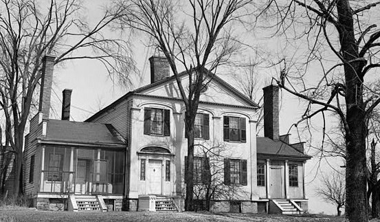
English: Judge Nathan Roberts House, State Highway 5, Canastota vicinity (Madison County, New York)
cropped |
|||||
| Data | ||||||
| Fonte | http://memory.loc.gov/cgi-bin/displayPhoto.pl?path=/pnp/habshaer/ny/ny0200/ny0262/photos&topImages=117115pr.jpg&topLinks=117115pv.jpg,117115pu.tif&title=1.%20%20Historic%20American%20Buildings%20Survey,%20M.E.%20Granger,%20Photographer%20Mar.%2028,%201934,%20VIEW%20FROM%20SOUTH%20(FRONT).%3cbr%3eHABS%20NY,27-CANA.V,1-1&displayProfile=0 | |||||
| Autore | M.E. Granger, Photographer | |||||
| Licenza (Riusare questo file) |
|

.jpg?uselang=it)
.jpg)
.jpg&action=edit)
.%3cbr%3eHABS%20NY,27-CANA.V,1-1&displayProfile=0)
| Posizione del soggetto | | Posizione di questa e altre immagini su: OpenStreetMap |
|---|
.jpg¶ms=043.068333_N_-075.758889_E_globe:Earth_class:object_region:US_type:landmark_scale:1500_&language=it)
Cronologia del file
Fare clic su un gruppo data/ora per vedere il file come si presentava nel momento indicato.
| Data/Ora | Miniatura | Dimensioni | Utente | Commento | |
|---|---|---|---|---|---|
| attuale | 19:25, 2 ago 2009 | | 553 × 323 (97 KB) | KudzuVine | {{Information |Description={{en|1=Judge Nathan Roberts House, State Highway 5, Canastota vicinity (Madison County, New York) cropped {{PD-USGov-Interior-HABS|NY,27-CANA.V,1-1}}}} |Source=http://memory.loc.gov/cgi-bin/displayPhoto.pl?path=/pnp/habshaer/ny/ |
Pagine che usano questo file
La seguente pagina usa questo file:
Utilizzo globale del file
Anche i seguenti wiki usano questo file:
- Usato nelle seguenti pagine di ar.wikipedia.org:
- Usato nelle seguenti pagine di ca.wikipedia.org:
- Usato nelle seguenti pagine di ceb.wikipedia.org:
- Usato nelle seguenti pagine di cy.wikipedia.org:
- Usato nelle seguenti pagine di en.wikipedia.org:
- Usato nelle seguenti pagine di es.wikipedia.org:
- Usato nelle seguenti pagine di eu.wikipedia.org:
- Usato nelle seguenti pagine di fr.wikipedia.org:
- Usato nelle seguenti pagine di ht.wikipedia.org:
- Usato nelle seguenti pagine di lld.wikipedia.org:
- Usato nelle seguenti pagine di pl.wikipedia.org:
- Usato nelle seguenti pagine di ru.wikipedia.org:
- Usato nelle seguenti pagine di sh.wikipedia.org:
- Usato nelle seguenti pagine di sr.wikipedia.org:
- Usato nelle seguenti pagine di uk.wikipedia.org:
- Usato nelle seguenti pagine di www.wikidata.org:
.jpg)