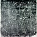
File:Song Dynasty Map.JPG
Vai alla navigazione
Vai alla ricerca

Dimensioni di questa anteprima: 590 × 599 pixel. Altre risoluzioni: 236 × 240 pixel | 472 × 480 pixel | 756 × 768 pixel.
File originale (756 × 768 pixel, dimensione del file: 436 KB, tipo MIME: image/jpeg)
Cronologia del file
Fare clic su un gruppo data/ora per vedere il file come si presentava nel momento indicato.
| Data/Ora | Miniatura | Dimensioni | Utente | Commento | |
|---|---|---|---|---|---|
| attuale | 09:25, 3 ago 2011 |  | 756 × 768 (436 KB) | Dragonet~commonswiki | better quality |
| 12:32, 3 nov 2007 |  | 834 × 843 (89 KB) | PericlesofAthens | {{Information |Description=The Chinese ''Yu Ji Tu'' (Map of the Tracks of Yu the Great), a map carved into stone in the year 1137 during the Song Dynasty, located in the Stele Forest of modern-day Xian, China. Yu the Great refers to the Chinese deity desc |
Pagine che usano questo file
Le seguenti 2 pagine usano questo file:
Utilizzo globale del file
Anche i seguenti wiki usano questo file:
- Usato nelle seguenti pagine di ast.wikipedia.org:
- Usato nelle seguenti pagine di cs.wikipedia.org:
- Usato nelle seguenti pagine di de.wikipedia.org:
- Usato nelle seguenti pagine di en.wikipedia.org:
- Usato nelle seguenti pagine di es.wikipedia.org:
- Usato nelle seguenti pagine di fr.wikipedia.org:
- Usato nelle seguenti pagine di hr.wikipedia.org:
- Usato nelle seguenti pagine di id.wikipedia.org:
- Usato nelle seguenti pagine di mt.wikipedia.org:
- Usato nelle seguenti pagine di nl.wikipedia.org:
- Usato nelle seguenti pagine di oc.wikipedia.org:
- Usato nelle seguenti pagine di pl.wikipedia.org:
- Usato nelle seguenti pagine di ru.wikipedia.org:
- Usato nelle seguenti pagine di sh.wikipedia.org:
- Usato nelle seguenti pagine di sl.wikipedia.org:
- Usato nelle seguenti pagine di sv.wikipedia.org:
- Usato nelle seguenti pagine di uk.wikipedia.org:
- Usato nelle seguenti pagine di vi.wikipedia.org:
- Usato nelle seguenti pagine di zh.wikipedia.org:
