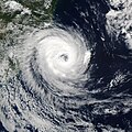
File:Catarina 2004-03-27 1630Z (cropped).jpg
Vai alla navigazione
Vai alla ricerca

Dimensioni di questa anteprima: 600 × 600 pixel. Altre risoluzioni: 240 × 240 pixel | 480 × 480 pixel | 768 × 768 pixel | 1 024 × 1 024 pixel | 2 048 × 2 048 pixel | 4 000 × 4 000 pixel.
File originale (4 000 × 4 000 pixel, dimensione del file: 2,46 MB, tipo MIME: image/jpeg)
Cronologia del file
Fare clic su un gruppo data/ora per vedere il file come si presentava nel momento indicato.
| Data/Ora | Miniatura | Dimensioni | Utente | Commento | |
|---|---|---|---|---|---|
| attuale | 06:29, 2 gen 2010 |  | 4 000 × 4 000 (2,46 MB) | Juliancolton | Reverted to version as of 18:58, 1 September 2006 |
| 19:55, 29 dic 2009 |  | 4 000 × 4 000 (2,12 MB) | Supportstorm | Image Adjustment: Auto levels on contrast and color | |
| 20:58, 1 set 2006 |  | 4 000 × 4 000 (2,46 MB) | Good kitty | == Summary == {{Information |Description=The MODIS instrument onboard NASA's Aqua satellite captured this true-color image of a rare tropical cyclone in the South Atlantic ocean just off the coast of Santa Catarina and Rio Grande do Sul, Brazil's southern |
Pagine che usano questo file
La seguente pagina usa questo file:
Utilizzo globale del file
Anche i seguenti wiki usano questo file:
- Usato nelle seguenti pagine di de.wikipedia.org:
- Usato nelle seguenti pagine di en.wikipedia.org:
- List of South America hurricanes
- Portal:Tropical cyclones/Featured article/List of South America tropical cyclones
- Portal:Tropical cyclones/Anniversaries/March
- Portal:Tropical cyclones/Anniversaries/March/28
- Wikipedia:Featured picture candidates/September-2008
- Wikipedia:Featured picture candidates/Cyclone Catarina 2004.jpg
- Wikipedia:Wikipedia Signpost/2009-01-03/Dispatches
- Wikipedia talk:Wikipedia Signpost/2009-01-03/Dispatches
- History of tropical cyclone naming
- User:LightandDark2000/My Notable Storms
- User:RandomInfinity17/Unusual areas of tropical cyclogenesis
- Usato nelle seguenti pagine di fr.wikipedia.org:
- Usato nelle seguenti pagine di gu.wikipedia.org:
- Usato nelle seguenti pagine di hi.wikipedia.org:
- Usato nelle seguenti pagine di hu.wikipedia.org:
- Usato nelle seguenti pagine di ko.wikipedia.org:
- Usato nelle seguenti pagine di ms.wikipedia.org:
- Usato nelle seguenti pagine di mwl.wikipedia.org:
- Usato nelle seguenti pagine di pl.wikipedia.org:
- Usato nelle seguenti pagine di pt.wikipedia.org:
- Usato nelle seguenti pagine di ro.wikipedia.org:
- Usato nelle seguenti pagine di sw.wikipedia.org:
- Usato nelle seguenti pagine di ta.wikipedia.org:
- Usato nelle seguenti pagine di uk.wikipedia.org:
- Usato nelle seguenti pagine di vi.wikipedia.org:
- Usato nelle seguenti pagine di zh.wikipedia.org:


